US States Map 1.4
Free Version
Publisher Description
US States Map - USA Topo Maps with 50 States
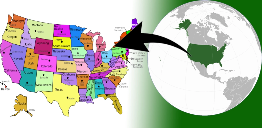
The United States of America is located on the North American Continent. The United States is bordered by the Pacific Ocean on its west coast, the Atlantic Ocean on its east coast, Canada to the north, and Mexico to the south.
The United States is a big country, and it definitely takes more effort to learn the US geography, US capitals, US states & American flags compared to other countries. Whether you're a high school student or just a curious learner, our US geography quiz 50 States will help you master US capitals, states, flags & US maps.
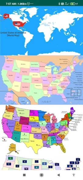
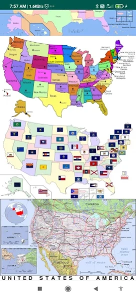
US States map contains information about all 50 US states, capitals, the state flag, and wiki links to know more about the state.
Capital Cities:- Via this Atlas app for Map Of USA you can get search for the Capital Cities of each state.
Must have mobile app features include:
50 us states map with capitals names
map of USA with states
u.s. states and capitals
united states map with cities
map of the USA with states and major cities' names
us atlas
American atlas
atlas of the united states
blank us map
political map of USA
us regions map
USA in world map
us river map
United states elevation map
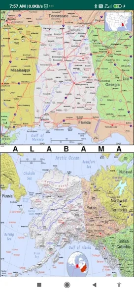
topographic map of us
united states road map
This physical map of the US shows the terrain of all 50 states of the USA
List of States:
the map of Alaska, Washington dc on us map, Chicago map USA, Washington map USA, map of united states of America and Canada,
Alabama, Arizona, Arkansas, California, Colorado, Connecticut, Delaware, Florida, Georgia, Hawaii, Idaho, Illinois, Indiana, Iowa, Kansas, Kentucky, Louisiana, Maine, Maryland, Massachusetts, Michigan, Minnesota, Mississippi, Missouri, Montana, Nebraska, Nevada, New Hampshire, New Jersey, New Mexico, New York, North Carolina, North Dakota, Ohio, Oklahoma, Oregon, Pennsylvania, Rhode Island, South Carolina, South Dakota, Tennessee, Texas, Utah, Vermont, Virginia, Washington, West Virginia, Wisconsin, Wyoming.
United States Bordering Countries:
Canada, Mexico
Regional Maps:
Great Lakes, U.S. Territories, North America, World
About US States Map
US States Map is a free app for Android published in the Teaching & Training Tools list of apps, part of Education.
The company that develops US States Map is Education point. The latest version released by its developer is 1.4.
To install US States Map on your Android device, just click the green Continue To App button above to start the installation process. The app is listed on our website since 2023-12-04 and was downloaded 1 times. We have already checked if the download link is safe, however for your own protection we recommend that you scan the downloaded app with your antivirus. Your antivirus may detect the US States Map as malware as malware if the download link to com.educationpoint.usstatemap is broken.
How to install US States Map on your Android device:
- Click on the Continue To App button on our website. This will redirect you to Google Play.
- Once the US States Map is shown in the Google Play listing of your Android device, you can start its download and installation. Tap on the Install button located below the search bar and to the right of the app icon.
- A pop-up window with the permissions required by US States Map will be shown. Click on Accept to continue the process.
- US States Map will be downloaded onto your device, displaying a progress. Once the download completes, the installation will start and you'll get a notification after the installation is finished.
